Port Lands Watch: East Harbour and the future of Toronto’s eastern waterfront
In the final part of our series on the evolving Port Lands, we look at East Harbour business district plans and what’s next for the eastern waterfront.

The rapid build-out of the greater Port Lands area and the creation of Villiers Island includes a lot of projects, from land formation, to flood protection, to transit and sustainable transportation infrastructure.
But these projects don’t together make up the final form of the shore of Lake Ontario in Eastern Toronto. In many ways, they are just the beginning.
The Port Lands are also going to get a major new business district.
Introducing East Harbour
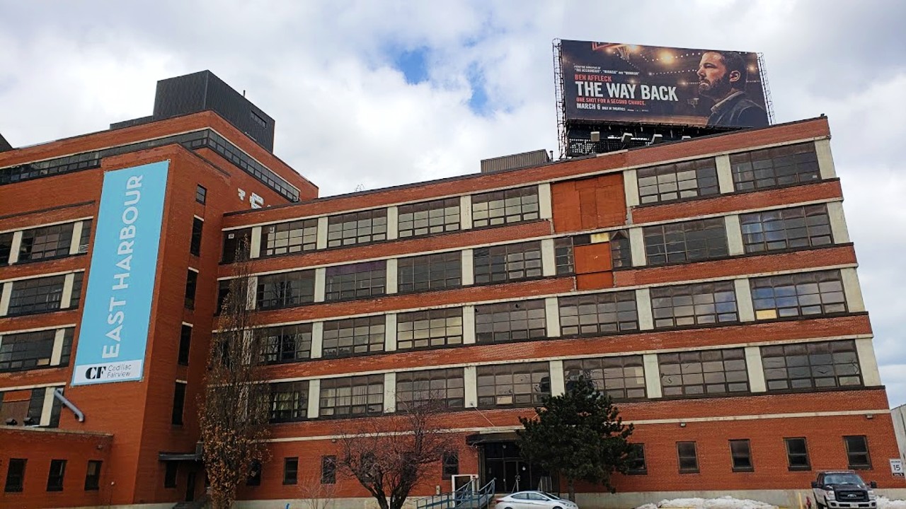
Just northeast of Villiers Island on the eastern shore of the Don is the old Unilever soap factory site. It’s bisected by the Lakeshore East and Stouffville rail corridors, and will be home to a major redevelopment project in the coming years.
Backed by Cadillac Fairview, which operates multiple shopping and office complexes in the city, it will be known as East Harbour.
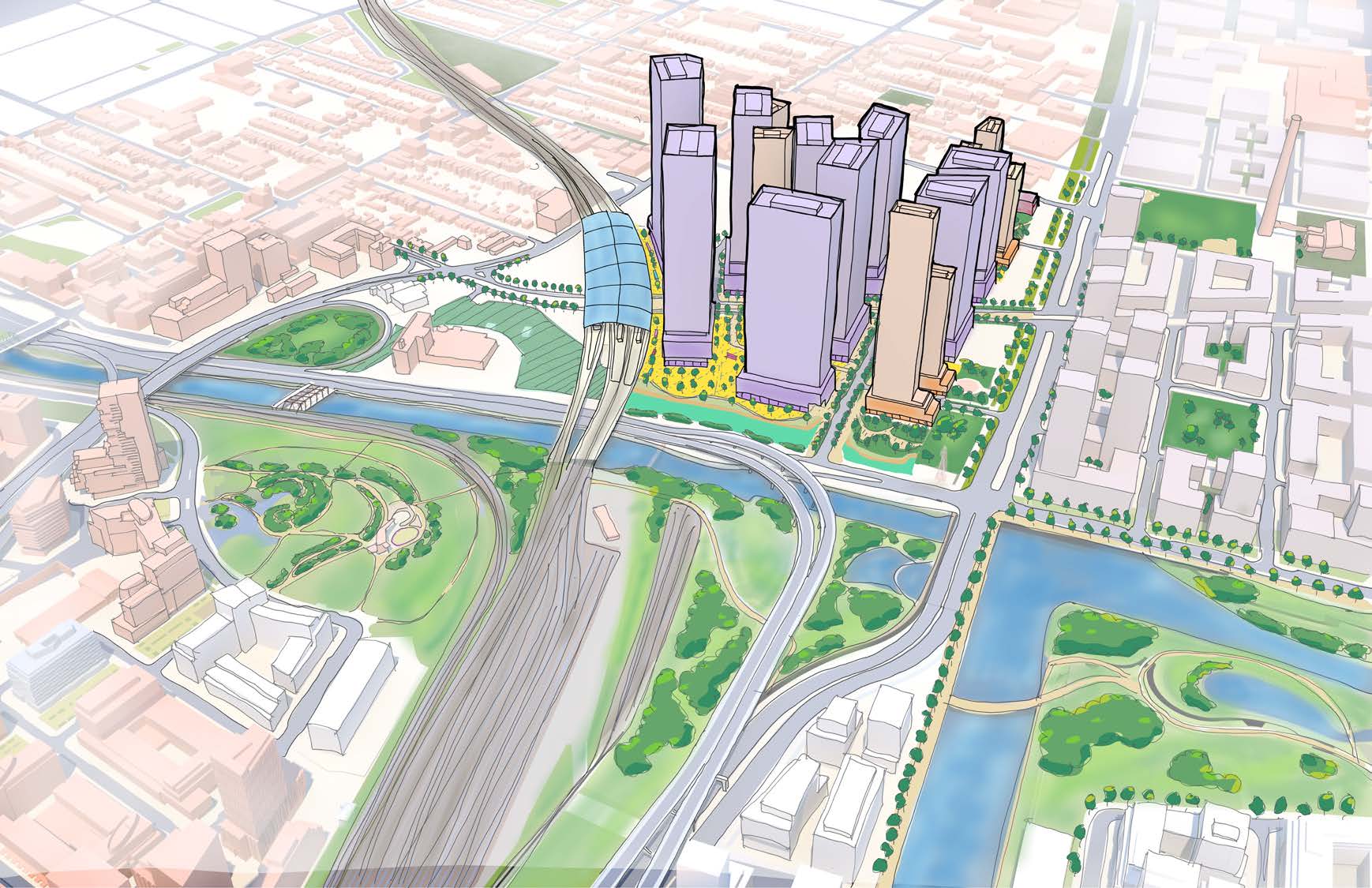
The scale of this development is hard to overstate: Current plans call for a number of major office towers built on the site, forming a dense and skyline-changing satellite business district, akin to London’s Canary Wharf or Paris’s La Defense.
The development will also include high-density residential buildings, which themselves might flow into other development south of Lake Shore Blvd. directly across from the new mouth of the Don River.
Of course, with the commercial property market in flux due to the massive shift to work-from-home, East Harbour may end up like large sites in North York and the South Core. That is, it could ultimately be developed with far more residential space than initially planned — making it more CityPlace and less La Defense.
Whatever the eventual breakdown of commercial to residential, the development will be connected to the downtown core via a major new East Harbour GO train station, as well as the new Ontario Line. The Broadview streetcar extension (mentioned in the previous article in this series) would travel perpendicularly directly underneath the major new facility, which will be exceeded in scale and connectivity only by Union Station.
While this streetcar extension will be of use to residents in nearby neighbourhoods such as Riverdale, it also has massive potential to connect Villiers Island and other burgeoning waterfront areas to this major new East Harbour employment hub.
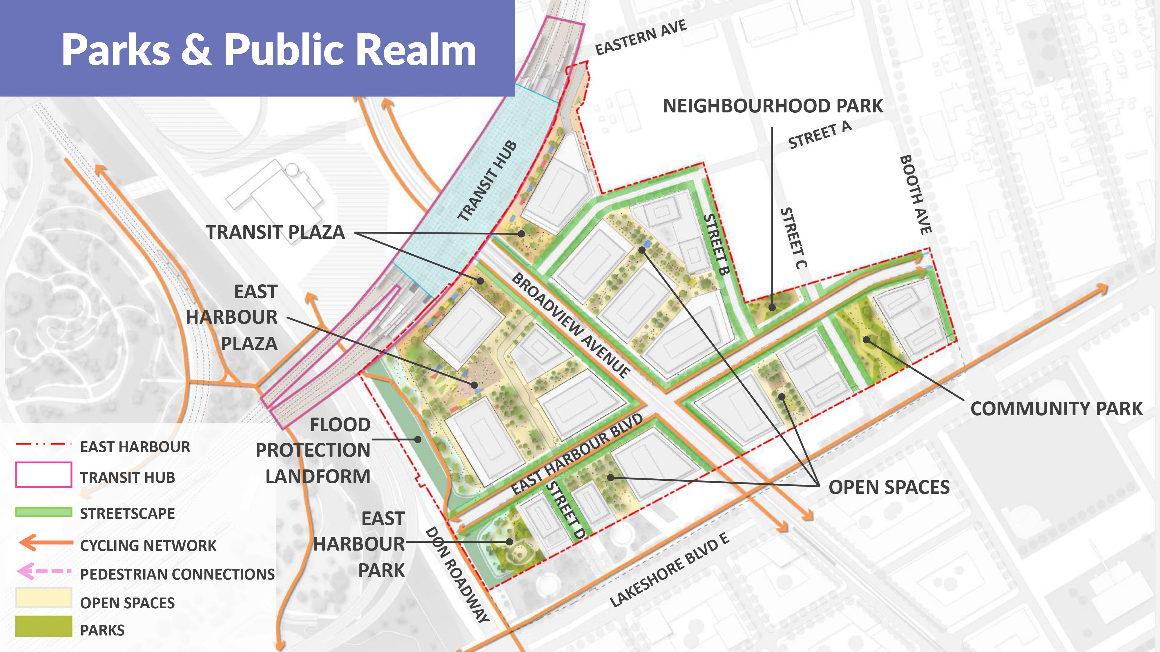
Within the development itself, the major blocks of buildings will generally be surrounded by spaces reserved for pedestrians and cyclists, and — as with Villiers Island — dedicated cycle tracks will exist along major arteries. All of this will go a long way to tie East Harbour to the greater Port Lands area as well as the rest of the waterfront and city.

More flood protection for the future
As you’d expect, more development at East Harbour means more green and public space. The development has such spaces sprinkled throughout, with three larger parks also forming part of the plans.
Given the location on the eastern bank of the Don, additional flood protection also needs to be provided. This will take the form of a berm, or flood-protection landform — similar to those seen at Corktown Common and at Villiers island. These give water room to move and rise, while still keeping it back from streets, homes, and other buildings.
On top of this, future phases of the Don River and Central Waterfront wet weather flow project will include two more major tunnels — one extending along Taylor Massey Creek, and another west along the now heavily developed waterfront from the mouth of the Don — on top of the Coxwell Bypass Tunnel already in construction.
At the same time, a lot of important conversations are happening across the city (and in other cities) with regards to the impact of hard surfaces on flooding. The idea here is to consider implementing policies, such as taxes based on square footage, that would encourage property owners with driveways or parking lots to improve onsite drainage and storage, or better yet replace hard surfaces with soft, permeable ones.
Streetcar green track, which could be used for the Broadview south extension, is yet another measure that could help mitigate stormwater runoff.
Not only would these efforts reduce the risk of floods downstream by slowing water down and giving it time to be absorbed into the ground, but plants can also filter out pollutants that collect in runoff.

Connecting the Port Lands to other city priorities
While a ton of change is already coming to the Port Lands, there is potential for far more in the future.
For example, in the 2022 Toronto municipal election, there was much discussion of a potential pedestrian bridge that would run from the Port Lands across the eastern channel to Ward’s Island.
Further discussion surrounds the future of Billy Bishop Toronto City Airport, which has a limited licence that may at some point not be renewed. Mayoral candidate Gil Penalosa, for one, campaigned on the idea that it become a standalone park.
This issue may come to a head sooner than expected because of Porter Airlines’ recent major jet purchase, which will already require moving a lot of traffic to Toronto Pearson.
The Waterfront and Port Lands specifically could also be a great place for Toronto to trial more attractive public EV chargers. Such infrastructure is common in major cities around the world, but Toronto’s implementation, consisting of large units nailed to wooden power poles, leaves a lot to be desired.
Providing more public charging on the eastern waterfront and in the Port Lands could not only attract more people to the area, but it could set a precedent for the rest of the city to follow suit and modernise the way vehicles receive their energy.
Heating energy is also another major consideration. The Well project at the west side of Toronto’s downtown is coming along with a major expansion of the city’s Deep Lake Water Cooling system, which is connected to many of downtown Toronto’s large office buildings.
It seems only natural that a similar expansion should be considered to the east of downtown, especially given the substantial development going on in the area. Because what’s clear today is that Toronto’s future is by the water.
Keep Digging
We hope you enjoyed the final piece in our four-part “Port Lands Watch.” If you missed them, we encourage you to check out the other pieces in the series:
- Part 1: What’s up with Villiers Island?
- Part 2: Why Waterfront Toronto is building a new mouth for the Don River
- Part 3: How Villiers Island will work for Torontonians without cars
Code and markup by Chris Dinn. ©Torontoverse, 2023