Port Lands Watch: How Villiers Island will work for Torontonians without cars
In part three of our series on the evolving Port Lands, we look at infrastructure for transit, bikes, and other modes of sustainable transport.

As we face both a housing and climate crisis, it’s never been more important that planners build neighbourhoods that can be accessed without a car. It’s a critical step in reducing our impact on the climate, and improving the affordability and equity of our cities.
It’s something you can already see in mostly developed neighbourhoods like the Canary District, but this kind of foreplanning hasn’t been the norm.
Some recent Toronto developments have sprouted up without high-quality public transportation. And as we’ve seen across the City of Toronto, retrofitting transportation infrastructure — from bike lanes to bus lanes — can be highly contentious, expensive, and shockingly slow.
Fortunately, making sure that residents can get around without a car in the Port Lands’ coming Villiers Island neighbourhood has been a major consideration throughout the design phase. Current plans include infrastructure for transit, bikes, and other modes of sustainable transportation.
Some of that is already taking hold: Cycle tracks along the new Cherry St. alignment and the Cherry St. south bridge have already proven popular with cyclists and pedestrians visiting the area to take in the skyline views.
But the work isn’t yet complete.

Building Villiers Island transit infrastructure
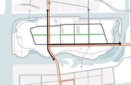
Getting around Villiers Island via transit has been a consideration from the beginning, and land has been set aside along both Cherry St. and Commissioners St., the two central thoroughfares for the area, for dedicated bus lanes or streetcar right-of-ways.
(Those right-of-ways are looking like they’ll be called into action sooner than later, as plans for the Waterfront East LRT have firmed up and become a top priority for the city.)
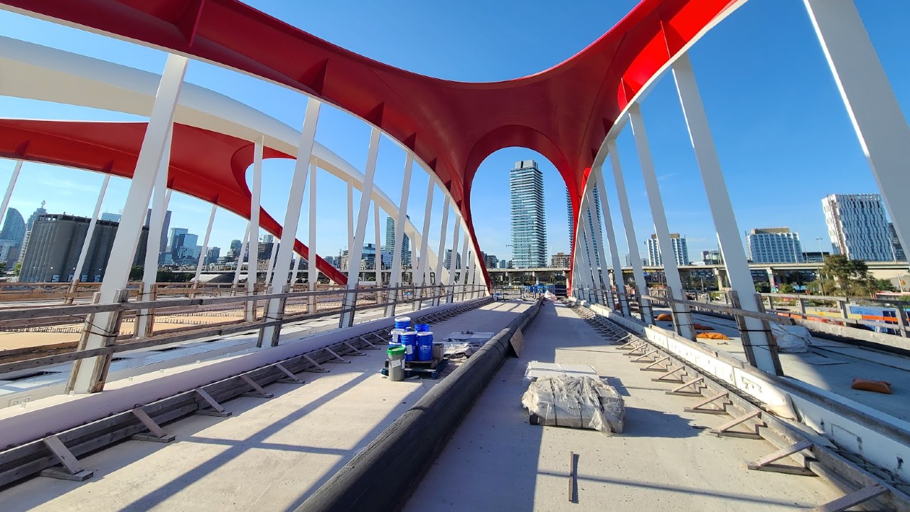
An additional transit bridge alongside the new road bridge has already been constructed across the Keating Channel at Cherry St. to provide a dedicated transit route, with more such bridges planned in the future at other crossings onto Villiers Island.
This is not unlike the Canary District, which features a short dedicated streetcar right-of-way serving a branch of the King streetcar route.
Extending from the Commissioners St. corridor, the dedicated transit corridor will likely continue further east in the future, which would mean another dedicated transit bridge to match the one on Cherry St. The bridge would cross the new river valley and connect to the major Leslie Barns Maintenance Facility that is the primary maintenance and storage facility for the new low-floor streetcars.
Current plans have also laid the groundwork for more aspirational ones in the long term. For example, a short extension south along Cherry St. would enable connections to Cherry Beach, which would be especially cool for residents of downtown and the Port Lands that have comparatively less access to traditional beach areas.
There’s even potential for an extension of the Broadview streetcar corridor south, which would open up some very interesting opportunities to connect residents from points east along the subway to the Port Lands. This will likely happen as part of the massive East Harbour development project.
Unfortunately, getting to Villiers Island is a different story, as no current streetcar routes directly serve the area from other parts of the city. This is hugely problematic, because development is continuing apace on Queens Quay East towards Villiers Island, and soon enough Villiers itself will have housing and more under development.
Having higher-order transit into and out of Villiers Island from day one is absolutely critical so that people moving into the neighbourhood can establish transit as part of their habits, which can be very hard to change after the fact. This is especially the case here, because a street-based bus system will provide much lower quality service than dedicated right-of-way streetcars, as they are susceptible to being stuck in traffic, and are generally less comfortable and efficient.
Luckily, there’s a glimmer of hope. The proposed Waterfront East LRT will see streetcars run south from Union Station, then east along Queens Quay to Cherry St. The City is studying options to extend the WELRT south on Cherry with a loop in the Port Lands. That said, approval, funding, and construction are nowhere close to being a done deal.

Making room for sustainable transportation
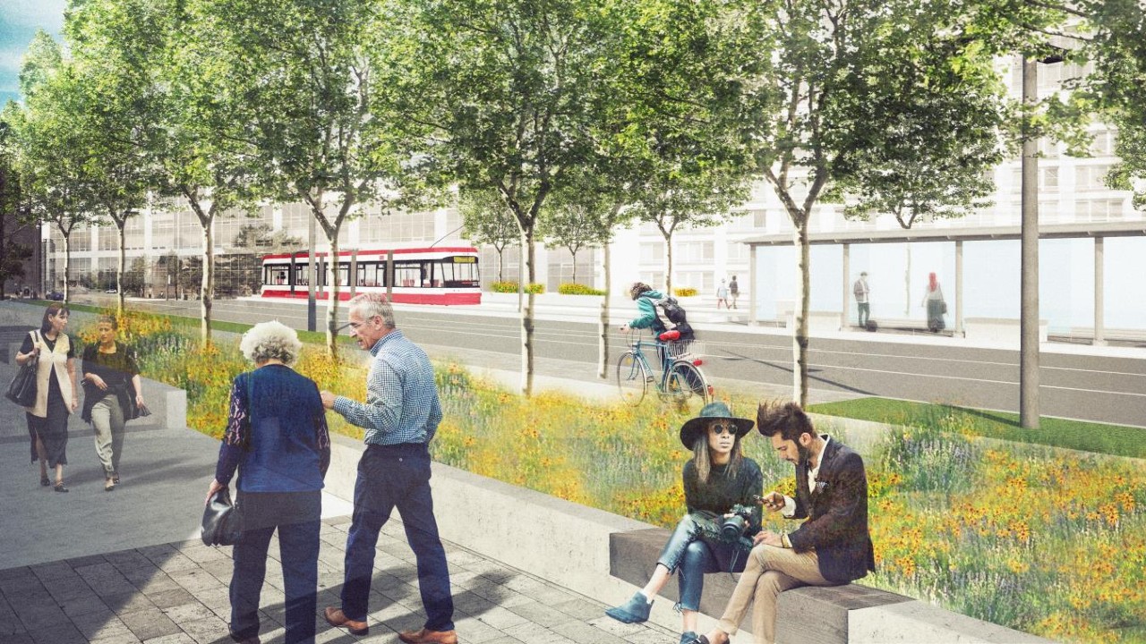
Public transit is only one element of the transportation plan. Space will be provided for cyclists throughout, which should connect nicely to the bike lanes in the city's east end. Intersections are also set to be better designed and much safer than previously developed neighbourhoods, with tighter corners and other safety enhancements based on Dutch-style road design. Moreover, roads in the neighbourhood aren’t designed to be major arterials, with a reasonable number of car lanes that won’t be disruptive to other modes of transport.
Bike Share Toronto’s major expansion plans, meanwhile, will bring new connection points to the Port Lands and Villiers Island in particular. (Though it would be nice to them expanded particularly with additional e-bike charging docks, which are currently in short supply.)
At the same time, all major streets will have dedicated cycle paths with physical dividers. While lesser streets won’t have these amenities, they should also be fairly comfortable for those on two wheels with less vehicular traffic present.
With the success of the aforementioned cycle tracks already in use, it seems clear that the Port Lands will be a popular area for cyclists.
Walking is not being overlooked either. The various parks — particularly the ones along the river valley — should be quite useful as connections from East Harbour into Villiers Island. Wide sidewalks with unusually nice (for Toronto) paving materials, as seen in the Canary District and along Queens Quay, should also make walking much more pleasant.
Once everything’s in place, the Port Lands will not be car-free, but the lack of major arterials coupled with enhanced public and active transport access should help keep their numbers in check.
Keep Digging
We hope you enjoyed the third piece in our four-part “Port Lands Watch.” If you missed them, we encourage you to check out the other pieces in the series so far:
- Part 1: What’s up with Villiers Island?
- Part 2: Why Waterfront Toronto is building a new mouth for the Don River
- Part 4: East Harbour and the future of Toronto’s eastern waterfront
Code and markup by Chris Dinn. ©Torontoverse, 2023