Introducing the Torontoverse cycling layer
A resource for anyone who bikes in the city.

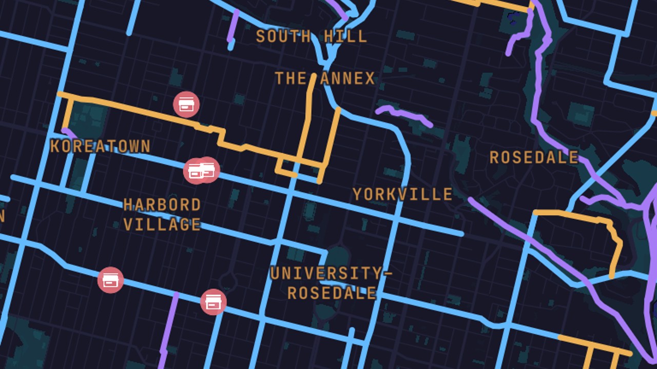
Welcome to the Torontoverse cycling layer. It helps you visualize the entire network of Toronto bike lanes, all in one zoomable map.
Cycling in the city can be intimidating, but it’s less so when you can plan out a route of dedicated lanes all the way to your destination.
This feature lets you do just that, allowing users to find lanes near their homes for commutes or recreational off-road rides. It both displays where bike lanes are located and differentiates by type — whether it’s a marked lane or shoulder, a shared street or roadway, or an off-road path or trail.
It also includes bike shops you can stop at on your way, and shows the prevalence of types of lanes in different regions of the Greater Toronto Area.
Here are some key points as you poke around the layer:
- To filter by path type, simply toggle the switches. You can also invert your selections by clicking on the “Path Types” header.
- Ditto for filtering by region. Just click on the “Regions” header to invert selections, as described above.
- Hover over a path for more details — such as start, end, and type — where available.
- Hover over a bike shop pin to get the name of each shop, and click to get address and contact info, as well as a checklist of services.
Is there anything you’d like to see added to this layer? If so, email us at user-feedback@geomodul.us.
Code and markup by Kyle Duncan. ©Torontoverse, 2022