Introducing the Torontoverse childcare layer
A resource for anyone raising young children in the city.
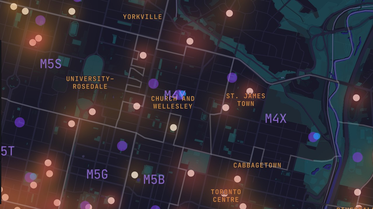
Welcome to the Torontoverse childcare layer. It’s been created to show the range and distribution of daycare facilities in the City of Toronto, all in a single zoomable map view.
Finding childcare in Toronto can be incredibly stressful. Just getting a sense of what’s out there — and how close it is to where you live — can be difficult. This feature aims to help with that.
We’ve used a “heat map” style to illustrate density of centres across the city, and included postal code boundaries and labels for a neighbourhood perspective. And for each centre we’ve provided details on which age groups are served.
Finally, we’ve also included a toggle-able switch to instantly add Toronto playgrounds and splash pads into the mix.
Here are some key points as you poke around the layer:
- You can filter agencies by the age groups they serve. If you’re looking only for daycares with infant spots, simply turn off the other age-range switches.
- Hover over any pin to see the name of the agency as well as its rough distribution by age. Click for more details and contact info.
- Click on a postal code to zoom in to that area.
- You can toggle the park features on and off, depending on your needs in the moment. Hover on a park for a name, and click the link to head to its website.
Is there anything you’d like to see added to this layer? If so, email us at user-feedback@geomodul.us.
Code and markup by Kyle Duncan. ©Torontoverse, 2022