The expansion of Toronto photo radar has arrived. Here’s where the new cameras will be located.
The system will grow from 50 to 75 cameras, with all new devices installed within two weeks.
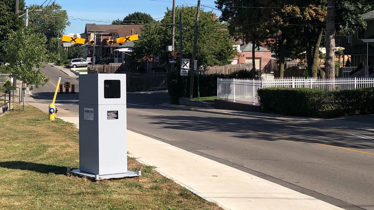
Toronto’s photo radar program is officially expanding.
On Thursday, Toronto mayor John Tory announced that 25 new speed enforcement cameras will be added to the system, bringing the total to 75.
“Expanding the Automated Speed Enforcement (ASE) program is a major step forward in making our neighbourhoods safer for everyone in Toronto and an effort that demonstrates our continued commitment to advancing Toronto’s Vision Zero Road Safety Plan,” said Tory, adding that he plans to install a total of 150 cameras during his current term.
The new camera locations were approved in February 2022, and the City installed 90-day warning signs at each in November. It will take approximately two weeks for all new devices to be fully activated and enforcing speed limits.
The system’s original 50 cameras are currently in service at their sixth round of locations and will continue rotating moving forward.
New ASE camera locations
The 25 new ASE cameras — one additional camera per ward — are in the following locations, which you can see highlighted in blue on the map:
- Thistle Down Boulevard east of Albion Road (Etobicoke North)
- Martin Grove Road south of Eglinton Avenue West (Etobicoke Centre)
- Mimico Avenue west of Station Road (Etobicoke-Lakeshore)
- Lansdowne Avenue near 108 Lansdowne Ave. (Parkdale-High Park)
- Pritchard Avenue near Batavia Avenue (York South-Weston)
- Sheppard Avenue West west of Keele Street (York Centre)
- Driftwood Avenue east of Jane Street (Humber River-Black Creek)
- Avenue Road north of Elwood Boulevard (Eglinton-Lawrence)
- Gladstone Avenue south of Cross Street (Davenport)
- Dennison Avenue south of Grange (Spadina-Fort York)
- Bloor Street West west of Clinton Street (University-Rosedale)
- Davisville Avenue east of Yonge Street (Toronto-St. Paul’s)
- Queen Street East near Sackville Street (Toronto Centre)
- Logan Avenue north of Wolfrey Avenue (Toronto-Danforth)
- Harrison Road near Vernham Avenue (Don Valley West)
- Sloane Avenue near Draycott Drive (Don Valley East)
- Freshmeadow Drive west of Applegate Crescent (Don Valley North)
- Senlac Road north of Elynhill Drive (Willowdale)
- Main Street south of Swanwick Avenue (Beaches-East York)
- Danforth Road east of Huntington Avenue (Scarborough Southwest)
- Lawrence Avenue East near Canlish Road (Scarborough Centre)
- Birchmount Road north of Bay Mills Boulevard (Scarborough-Agincourt)
- Tapscott Road west of Blackwell Avenue (Scarborough North)
- Orton Park Road south of Ellesmere Road (Scarborough-Guildwood)
- Lawrence Avenue East west of Port Union Road (Scarborough-Rouge Park)
Further photo radar reading
Want more? Click here for our breakdown of the photo radar system — including how much money it makes, and where the busiest cameras are — as it heads toward its third birthday.
Code and markup by Chris Dinn. ©Torontoverse, 2023